California Hiking Trails Trails
Morro Bay
Pismo
SLO
Cayucos Big
Sur Harmony
Paso Los Osos
Ragged
Point San Simeon
California Hiking Trails!
The
Point Buchon Trail - Los Osos, Ca.
Spectacular Views
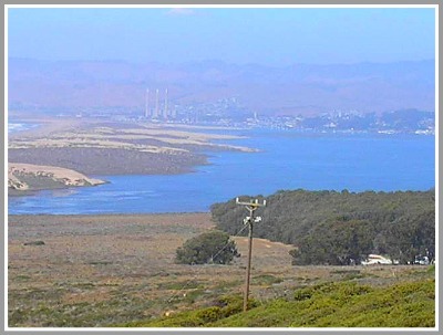
This hike is not as strenuous as Velencia or the Oats trails but it will give you a good work out mingled with fresh air and outrageous views of Morro Bay and other areas of the coast.
Oats Peak is the second highest peak in Montana De Oro State Park. It is 1373 feet above sea level. Out of all the California Hiking Trails this is one of the most interesting hikes in the region.
Regardless of the reason, for allowing the public to enjoy this California Hiking Trail, it is a real benefit to the locals and visitors to our great county.
INFORMATION ABOUT THE OATS PEAK TRAIL.
1. This trail is about 5.5 miles in distance. It is good hike so make sure you bring a back back full of goodies, water and anything else you might need to stay safe. The hike will take you about 3 hours unless you are in super shape and run half the way.
2. POINT BUCHON TRAIL Disclosure:
The Point Buchon Trail poses serious hazards to hikers, including by
way of example only and without limitation: steep cliffs, coastal bluffs, uneven terrain and rock outcroppings, steep grades, crumbling earth, sinkholes, changeable ocean,creek and weather conditions, lightning, wildlife, rattlesnakes, ticks, working ranch operations (electric fencing, livestock, and working animals), and poison oak. There is a risk of my becoming ill or injured in an area remote from medical care and Pacific Gas and Electric Company cannot guarantee the availability of emergency medical services or emergency transportation to medical facilitie. Follow this link for more information PG&E
3. Now let me tell you how to get to this great California hiking trail. Trailhead: From Highway 1 in Morro Bay, take the S. Bay Blvd. Exit turn south towards the ocean and follow the signs for Montana De Oro and Morro Bay State Parks. Stay on S. Bay Blvd for four miles. Turn right onto Los Osos Valley Road (which becomes Pecho Valley Road after 1.5 miles) and follow it for 5.25 miles to the turnout for the Valencia and Oaks Peak Trail.The Point Buchon Trailhead is accessed through the south end of Montana de Oro State Park (Coon Creek Parking Lot).
You have to make reservations to hike this trail. To make reservation CLICK HERE.
From the 101, exit Los Osos Valley Road in San Luis Obispo, head West and follow it for 12 miles to the park. (Lat:35.26334 Lon:-120.87235)
Click on this link for more information on California Hiking
More
Trails
Trails in Big Sur Click HereHarmony Headlands Trail Click Here
Cambria Hiking Trails Click Here
Travel Booking Deals
Central Coast Travel Adventures is excited about the opportunity to help you book flights, cars, motels, hotels,and tours. We are here to serve you and make your visit to the coast a visit to remember.Expedia
- If you are looking for great deals Central Coast Travel Adventures
aims to please. Get
great travel deals on Expedia.ca
Hotwire - That's
not all if you want one more option try Hotwire.com Central Coast Travel Adventures wants
you to get the best deal possible on rooms etc.